David Rumsey
ArcGIS, QGIS or web apps can simply use this map with web map services. WMTS, TileJSON or XYZ tiles are provided for quick access to processed maps.
Sign in to get links.
Sign in to download GeoTIFF.
Overlay & compare
iiif viewer, iiif info json
Website
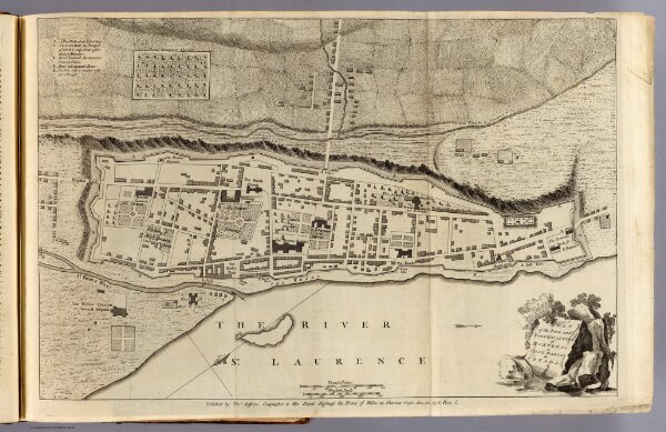
Montreal or Ville Marie.
4796.003
pilot3
Plan of the town and fortifications of Montreal or Ville Marie in Canada. Published by Thos. Jefferys, Geographer to His Royal Highness the Prince of Wales at Charing Cross, Jan 30, 1758. Price 2s. (1760)
1758
1760
Jefferys, Thomas
Thomas Jefferys
51 × 34 cm
1 : 3300