David Rumsey
ArcGIS, QGIS or web apps can simply use this map with web map services. WMTS, TileJSON or XYZ tiles are provided for quick access to processed maps.
Sign in to get links.
Sign in to download GeoTIFF.
Overlay & compare
iiif viewer, iiif info json
Website
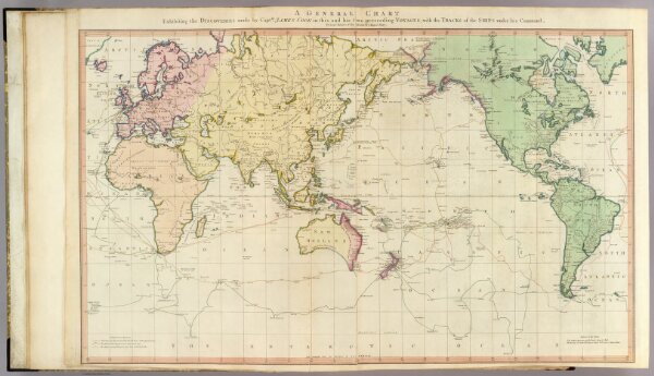
General chart.
2104.005
pilot4
A general chart exhibiting the discoveries made by Captn. James Cook in this and his two preceeding voyages; with the tracks of the ships under his command, by Lieutt. Roberts of His Majesty's Royal Navy. (London, published by W. Faden, 1811)
1811
Roberts, Henry, Lieut.
William Faden
91 × 58 cm
1 : 45000000