David Rumsey
ArcGIS, QGIS or web apps can simply use this map with web map services. WMTS, TileJSON or XYZ tiles are provided for quick access to processed maps.
Sign in to get links.
Sign in to download GeoTIFF.
Overlay & compare
iiif viewer, iiif info json
Website
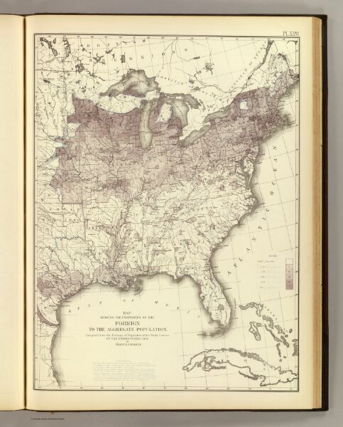
Foreign population proportion 1870.
3566.023
pilot4
Map showing the proportion of the foreign to the aggregate population. Compiled from the returns of population at the ninth census of the United States 1870. By Francis A. Walker. (Julius Bien, Lith., 1874)
1874
Walker, Francis Amasa, 1840-1897
U.S.
38 × 51 cm
1 : 7200000