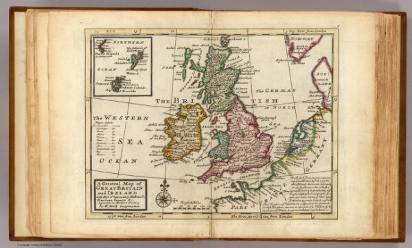
A general map of Great Britain and Ireland, with part of Germany, Holland, Flanders, France &c. Agreeable to modern history. By H. Moll Geographer. (with Farro, Schetland and Orkney islands). (Printed for Tho: Bowles next ye Chapter House in St. Pauls Church Yard, & John Bowles at the Black Horse in Cornhill, London 1736?)