David Rumsey
ArcGIS, QGIS or web apps can simply use this map with web map services. WMTS, TileJSON or XYZ tiles are provided for quick access to processed maps.
Sign in to get links.
Sign in to download GeoTIFF.
Overlay & compare
iiif viewer, iiif info json
Website
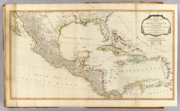
West Indies.
2310.083
pilot4
A new and complete map of the West Indies. Comprehending all the coasts and islands known by that name. By Monsr. Danville; with several emendations and improvements. London, Published by Laurie & Whittle, 53 Fleet Street, 12th May, 1794.
1794
1804
Robert Laurie & James Whittle
Laurie & Whittle
86 × 47 cm
1 : 6400000