David Rumsey
ArcGIS, QGIS or web apps can simply use this map with web map services. WMTS, TileJSON or XYZ tiles are provided for quick access to processed maps.
Sign in to get links.
Sign in to download GeoTIFF.
Overlay & compare
iiif viewer, iiif info json
Website
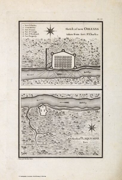
Sketch of new Orleans taken from fort St. Charles.
4664.026
missinglocation
Sketch of new Orleans taken from fort St. Charles. Sketch of Plaquemine Fort. Grave par Tardieu l'aine. PL. 36.
1796
Tardieu, P.F.
Arthus Bertrand
15 × 24 cm