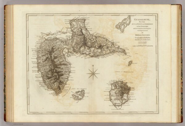
Guadaloupe, done from actual surveys and observations of the English whilst the Island was in their possession, with improvements by Thomas Jefferys, Geographer to the King. London, printed for Robt. Sayer, Map and Printseller, no. 53 in Fleet Street, as the Act directs, 20 Feby. 1775.